Every classic trail in Nepal was carved by moving water long before footpaths and stone steps existed. When you understand the river you walk with, you understand the mountain itself.
Popular Trekking Destinations in Nepal and the Rivers That Lead to Them
Himalayan valleys are defined by their drainage systems. Here is where Nepal's premier trekking routes lead and the legendary rivers that guide your steps:
• Kanchenjunga Base Camp: Follows the Tamor River and its high-altitude Ghunsa Khola branch in eastern Nepal.
• Makalu Base Camp: Follows the wild Barun Khola, which converges into the mighty Arun River.
• Everest Base Camp, Gokyo Lakes & Three Passes: Follow the turquoise Dudh Koshi ("Milk River"), born in the Khumbu glaciers directly beneath Lhotse, Nuptse, and Ama Dablam.
• Island Peak & Chhukhung Valley: Follow the Imja Khola, a glacial tributary feeding the Dudh Koshi.
• Rolwaling Valley & Tsho Rolpa: Follow the turbulent Rolwaling Khola directly beneath the sacred peak of Gauri Shankar.
• Langtang Valley & Gosaikunda: Follow the roaring Langtang Khola beneath Langtang Lirung, connecting to the headwaters of the Trishuli River.
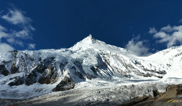
• Manaslu Circuit & Tsum Valley: Follow the dramatic gorge of the Budhi Gandaki River as it circles the world’s eighth highest mountain.
• Annapurna Base Camp (Sanctuary): Follows the cascading Modi Khola into the Annapurna Sanctuary, directly beneath Machhapuchhre (Fishtail).
• Mardi Himal Trek: A panoramic ridge trek high above the Mardi Khola valley, facing the Machhapuchhre ridge.
• Annapurna Circuit & Tilicho Lake: Follow the Marsyangdi River winding up to alpine Manang, then descend along the legendary Kali Gandaki down from Thorong La.
• Muktinath & Upper Mustang: Follow the ancient Kali Gandaki River, which cuts one of the deepest gorges on Earth between Dhaulagiri (8,167 m) and Annapurna I (8,091 m).
• Dhaulagiri Base Camp & Circuit: Follow the rugged Myagdi Khola, a remote tributary of the Kali Gandaki.
• Shey Phoksundo & Dolpo: Follow the pristine Phoksundo Khola, draining from Phoksundo Lake into the Bheri River.
• Rara Lake: Nestled peacefully in the remote Mugu Karnali river basin of western Nepal.
• Humla, Limi Valley & Mount Kailash Route: Follow the wild Humla Karnali, rising near the Tibetan border plateau.
• Saipal (7,031 m) in Bajhang: High alpine meltwater directly feeds the Seti Karnali.
• Api Himal (7,132 m) in Darchula: Drains westward toward the Mahakali, Nepal's western border river.
Trail Water Diagnostics: What Himalayan Rivers Tell You on the Trail
Experienced Himalayan guides read river behavior like a weather forecast. Watch the water closely to understand trail conditions ahead:
• Milky Grey Water: Glacier-fed. Moving ice grinds granite into microscopic "rock flour" (silt), suspending fine minerals that turn the river pale and milky.
• Turquoise Water: Glacial silt reflecting morning sunlight—commonly spotted below high-altitude terminal moraines and alpine glacial lakes.
• Clear Water: Sourced primarily from underground springs, aquifers, or recent local rainfall rather than active glacial melting.
• The Daily Melt Rhythm: During warm trekking months, glacial rivers hit their lowest flow in the early morning before sunlight strikes the ice, and crest in late afternoon. Always plan unbridged stream crossings early in the morning.
• Sudden Water Rise on a Sunny Day: Blue skies above you do not mean dry conditions everywhere. Intense melting or a sudden cloudburst upstream can trigger water surges hours before you see clouds.
• Sudden Drop in River Flow: A sudden drop in water volume is a serious warning sign. It often signals a temporary blockage upstream, such as a landslide dam. Alert your mountain guide immediately.
• Deep Rumbling at Night: Hear thunder under the water after dark? That is the sound of massive boulders tumbling along the riverbed during peak flow. It signals immense hydrological force.
• Seasonal Flow Patterns: Himalayan rivers run highest and wildest during the summer monsoon (June–September), run clearest in autumn (October–November), and shrink to winter lows (December–February).
• River Size Indicates Direction: As you ascend toward base camps, roaring torrents taper into babbling brooks, then trickle into glacial snouts. The river's shrinking volume confirms you are nearing its icy birthplace.
• Wide, Braided Channels: A riverbed split into multiple shallow gravel threads reveals a river that frequently shifts during flash floods. Never pitch tents near braided channels.
Mountain Flash Floods: The Basics Every Trekker Should Know
Often termed "mountain tsunamis," flash floods in the Himalayas typically trigger from three sources: heavy monsoon rain, Glacial Lake Outburst Floods (GLOFs), or landslide dam breaches. Licensed local guides continually evaluate river behavior, sky conditions, and slope stability to keep you out of harm's way.
River Valley Safety on Expeditions & High Treks:
• Approaches follow river valleys for days before climbing begins.
• Professional teams execute river crossings early in the morning when glacial runoff is minimal.
• Safe camps are placed well away from active flood channels and unstable moraine margins.
Essential River Safety Tips for Trekkers:
• Stay on the main path and away from loose water edges.
• Verify trail conditions with local lodges and tea houses.
• Respect rest days or reroutes as sound mountain judgement.
• Trust your local guide. Licensed guides know the shifting river currents and bridges best.
"Walk with the river. It's been to the summit already."